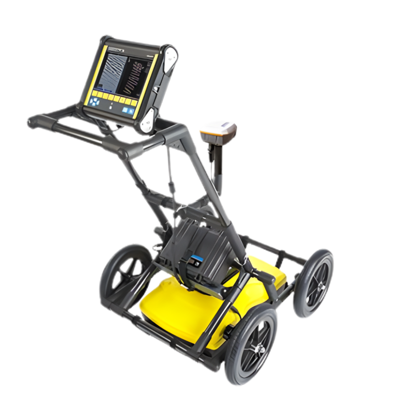
LMX200™ GPR
The LMX200™ provides unprecedented insights and target confidence to detect traditionally non-locatable subsurface features such as:
- Non-metallic pipes, including PVC and asbestos cement
- Underground Electrical Cable
- Concrete storm and sewer systems
- Utilities where installed tracer wiring has failed
- Underground storage tanks and drainage tiles
- Septic system components
- Non-utility structures such as vaults, foundation walls and concrete pads
Public utility systems and local governments require that the positions of underground systems are located and marked. This helps in planning projects and avoiding risks and hazards. The LMX200™ builds on the capabilities of the LMX100™ and adds further features to help you locate and map these utilities. It adds the powerful Grid Scan mode and the ability to use an external GPS to take full advantage of SplitView and MapView.
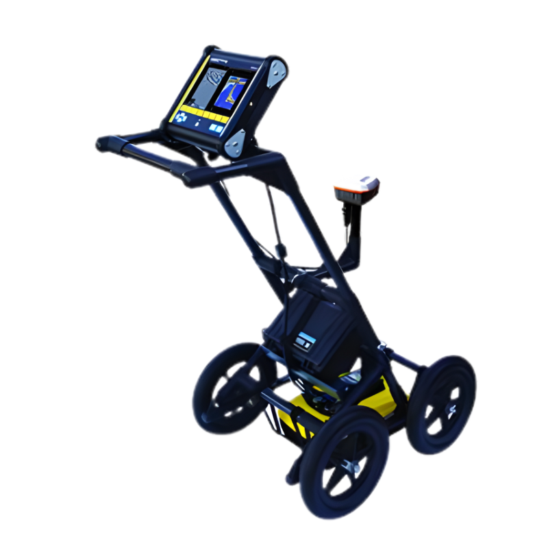
LMX150™ GPR
Ground Penetrating Radar (GPR)
Our Sensors & Software LMX150™ is a compact, high resolution utility locating system for your locating and mapping needs. LMX150™ GPR complements traditional pipe and cable locators and allows you to locate targets below the surface such as:
- Metal utilities, including pipes and cables
- Non-metallic pipes, including PVC and asbestos cement
- Concrete storm and sewer systems
- Utilities where installed tracer wiring has failed
- Underground storage tanks and drainage tiles
- Septic system components
- Fiber optic cables
- Non-utility structures such as vaults, foundation walls and concrete pads
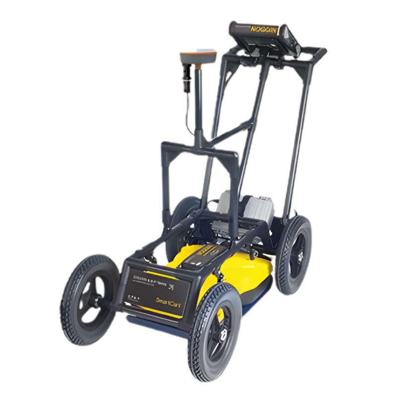
NOGGIN Ground Penetrating Radar (GPR)
If you need a high-performance, configurable GPR that is adaptable for multiple applications, the NOGGIN is the right choice for you.
The NOGGIN has sensors ranging from 1000 MHz to 100 MHz. Simply choose the sensor that provides the depth penetration and resolution best suited for your application. Noggins can be used for high resolution surveys of concrete buildings and structures, bridge decks, pavement, runways and underground mines.
- SmartCart® – durable, 4-wheeled, folding cart for fast, efficient data acquisition over smooth to moderately rough terrain.
- SmartTow™ – designed for hand-tow surveys over smooth to rough terrain, such as grassy, brush covered or rocky surfaces.
- SmartSled™ – designed for vehicle-towed surveying over smooth to rough open terrain, such as agricultural fields, grass, gravel roads or rocky surfaces.
- SmartChariot™ – designed for vehicle-towed surveys covering large, smooth, open areas, such as roads, bridges, large parking lots and garages, and open fields like golf courses and parks.
- SmartHandle™ – designed for pushing or pulling the Noggin over a smooth terrain. Light & compact for vertical or overhead surveys, and surveys in confined spaces.
Precision and Marker Locator Range
- Home
- PRODUCT LINES
MRX SG Survey Grade Locator
Mapping and Digital Solutions, Precision and Marker Locator Range
The MRX SG is the most advanced RF (Radio Frequency) marker locator in the MRX range, combining precision line locating, marker ball detection, and survey-grade accuracy in a single, powerful solution. Compatible with both Android™ and iOS®, the MRX SG is built for professionals who need to find buried utilities and marker balls, as well as map them with confidence.
The MRX SG delivers precision locating, high accuracy mapping, and rugged reliability for demanding field environments.
RF Markers
RF markers help locate underground utilities like plastic pipes, fiber optic cables, and critical points in dense networks. There are various types, such as marker balls, near surface, mid-range and full range markers. These RF markers are buried directly above or beside the utility, making them essential for hard-to-find assets. Radiodetection’s RF marker locators have been designed to locate the most common RF markers.
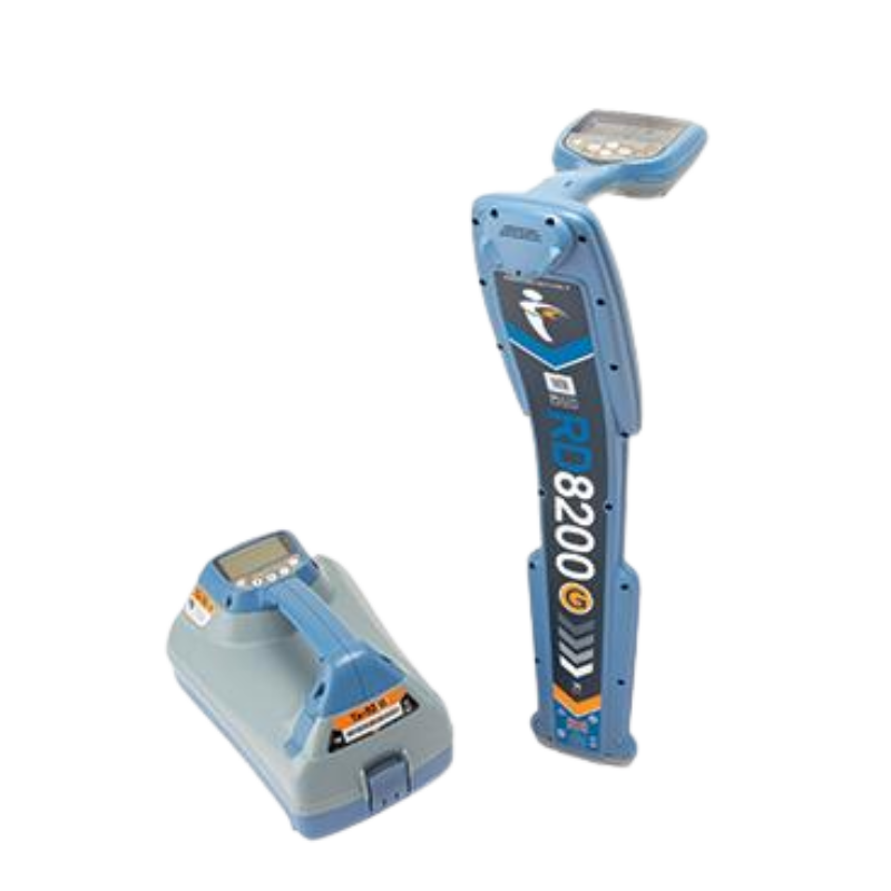
RD8200SG Survey Grade Locator
Mapping and Digital Solutions, Precision and Marker Locator Range
Locate and map buried utilities in a single operation with the RD8200SG – Survey Grade, available for Android™ and iOS®. The RD8200SG is our most advanced, combined mapping and utility locating solution that enables users to map buried utilities with survey grade accuracy.
Map It Your WayMap It Your Way
Flexibility is at the heart of our mapping solutions, allowing customers to choose the solution that is most suitable for their business. We offer turnkey solutions for those new to the world of utility mapping, while utility mapping experts can connect into their advanced systems
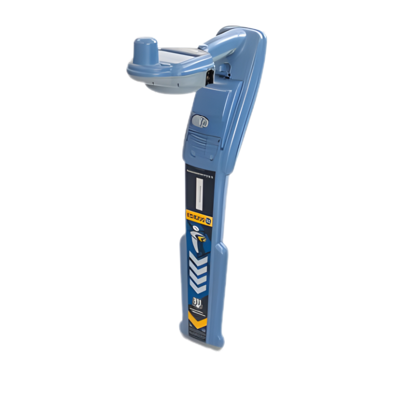
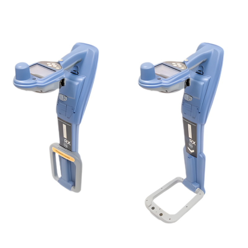
RD8200 Cable and Pipe Locators
Precision and Marker Locator Range
Damage prevention and operational efficiency are the biggest challenges facing our customers solve these problems with the new RD8200®. Designed with the operator in mind, it is our most advanced and capable range of precision locators.
Speed, accuracy and reliable performance
- Easy to setup and use
- Sun light readable display, high performance audio system and vibration alerts for noisy environments
- Sensitive and accurate signal processing for reliable results
Adaptable in challenging environments
- Ideal for congested underground infrastructures
- Rejects strong interfering signals
- Identify target power cable in the presence of many