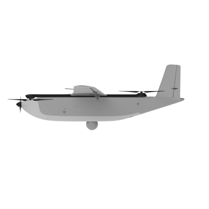
DELAIR DT46
Long range made easy
1 drone – 2 solutions. Convertible on the field in just 2 minutes.
VTOL version
- Endurance Up to 3h30
- Total weight / payload 25 kg / 5 kg
- Wingspan / Length 4.5 m / 2 m
- Operating conditions -10°C to +50°C / max wind : 16 m/s
- Deployment time 15 min
- Take off / Landing
- VTOL / Fully automatic 10m x 10m
- DRI (vehicle) Day : 20 / 9,5 / 4,3 km | Night : 2,7 / 1,1 / 0.55 km
- Fixed-wing version
- Endurance Up to 6h30
- Total weight / payload 20 kg / 5 kg
- Wingspan / Length 4.5 m / 2 m
- Operating conditions -10°C to +50°C / max wind : 16 m/s
- Deployment time 15 min Take off /
- Landing
- Catapult – Belly / Fully automatic 150m x 30m
- DRI (vehicle) Day : 20 / 9,5 / 4,3 km | Night : 2,7 / 1,1 / 0.55 km
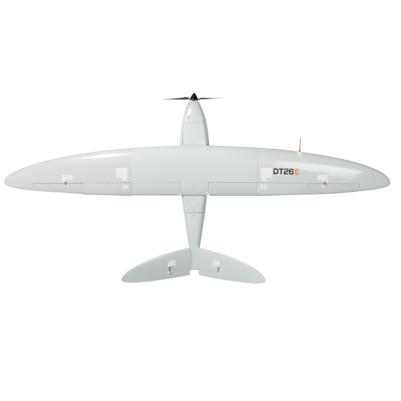
DELAIR DT26E Surveillance
The night and day long range surveillance solution
Characteristics
- Endurance Up to 170 min
- Weight (payload included) 15 kg
- Wingspan / Length 3.3 m / 1.6 m
- Material Composite (fiberglass, carbon, kevlar), EPP foam
- Deployment time 8 min
- Take off / Landing Catapult / Belly (all terrain)
- Cruise speed 57 km/h (35 mph)
Sensor
- Type Gyrostabilized EO/IR video camera
- Pan – Tilt / Angular resolution Infinite range / 25 μRad
- EO specifications Zoom: x 30 optical / FOV: 1.7 to 62,9° /
- Resolution: 720 x 576 px
- IR specifications Zoom: Digital (continuous) /
- FOV: 25° / Resolution: 640 x 480 px /
- Wavelength: 8 to 14 μm
- Tracking Videotracking, geotracking, «click and track» feature
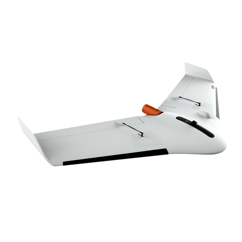
Delair UX11
The Smartest Mapping Drone
The Delair UX11 is a fixed-wing professional mapping drone offering significant productivity gains, unprecedented ease of use and high quality aerial data acquisition.
Map and digitize large areas with great accuracy
- Ease of use
- High productivity
- Quality Data
The Delair UX11 is an ideal drone solution for highly precise and easy mapping. It delivers integrated features for before, during and after flight operations, including an embedded global shutter camera, centimeter-level precision GNSS sensor, post processed kinematic (PPK) capabilities for survey-grade results, and both 2.4 GhZ wireless and 3G/4G cellular connectivity to operate anywhere. The drone’s operational performance (allowing flights of up to 80 minutes covering over 300 acres at 400 feet) significantly lower the total cost of ownership compared to other surveying and mapping options.