PIX4D mapper
Reliable photogrammetry software for classic drone mapping
Capture: Capture RGB, thermal, or multispectral images with any camera or drone and import them to PIX4Dmapper.
Digitize: PIX4Dmapper’s photogrammetry algorithms transform your ground or aerial images in digital maps and 3D models. Seamlessly process your projects on your desktop using our photogrammetry software, or bundle with PIX4Dcloud for online processing.
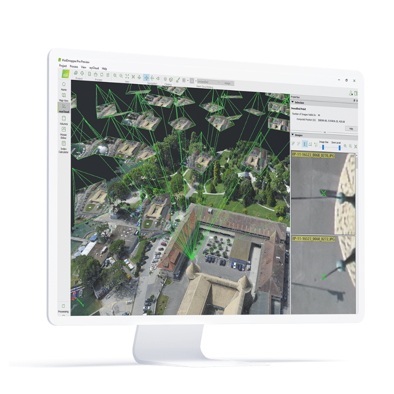
Control: Use the power of photogrammetry in the rayCloud environment to assess, control and improve the quality of your projects.
Use the quality report to examine a preview of the generated results, calibration details, and many more project quality indicators.
Measure & inspect: Accurately measure distances, areas, and volumes.
Collaborate & share: Streamline project communication and teamwork.
Selectively and securely share project data and insights, with your team, clients, and suppliers, using standard file formats.
Photogrammetry solution to power applications across industries, Advanced data processing for precise results
PIX4D matic
Keep control of each processing step on your local machine
The optimized software for the next surveying and mapping challenges
Bigger datasets, accurate results
PIX4Dmatic processes thousands of images while maintaining survey-grade accuracy, halving the processing time, without the trouble of splitting and merging.
Fully automated processing
Developed in close-collaboration with surveyors and mapping professionals to streamline your workflow: import, process and assess the quality of a project in just a few clicks, and move seamlessly from PIX4Dmatic to PIX4Dsurvey.
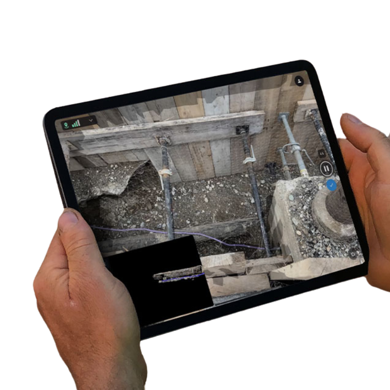
Terrestrial workflow
Leverage the benefits of both photogrammetry and LiDAR technology. Process LiDAR and RGB image outputs from PIX4Dcatch for a full terrestrial workflow. Easy and desktop-based.
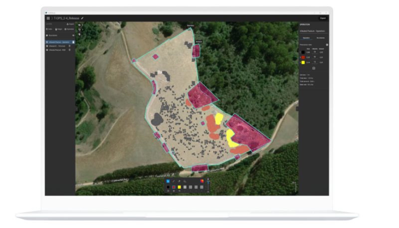
PIX4D fields
Hybrid drone and satellite mapping software for aerial crop analysis and precision agriculture
Saving time, money, and agricultural inputs has never been easier.
Compatible with industry leaders
Ready-to-use & customizable variable rate and spot spraying maps for spray drones, tractors, and field sprayers.
ISOXML for standard ISOBUS machine terminals