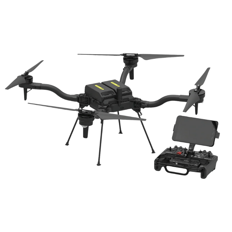
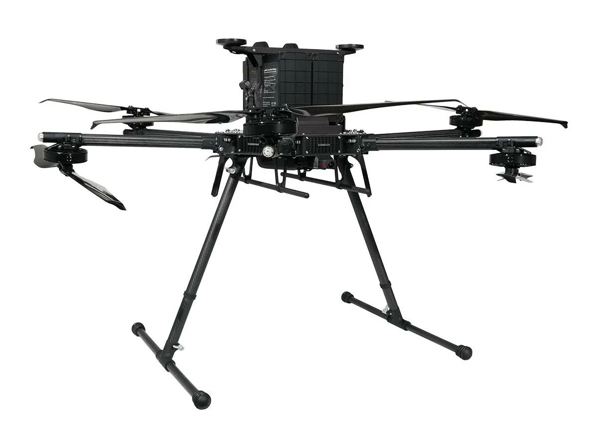
DJI Matrice 400
DJI Matrice 400, the enterprise flagship drone platform, boasts an impressive 59-minute flight time, a payload capacity of up to 6 kg, and integrated rotating LiDAR and mmWave radar for power-line-level obstacle sensing. It also supports the O4 Enterprise Enhanced Video Transmission and Airborne Relay Video Transmission, ensuring safer handling and easier operations. Combining Smart Detection with visible and thermal imaging, AR projection, ship-based takeoff/landing, and advanced automation, Matrice 400 excels in emergency response, power inspections, mapping, and AEC.
Key Features
- Extended Flight Time, High Speed Performance. 59 min forward flight / 53 min hover.
- Up to 6kg Payload Capacity. Fly up to seven simultaneous payloads.
- Safe and Reliable Flight. An integrated rotating LiDAR + mmWave radar + full-color low-light vision system
- Enhanced Intelligence and Efficiency. Smart Detection and AR Projection.
- Automated Operation. Natively supports DJI Pilot 2 quick-task templates.
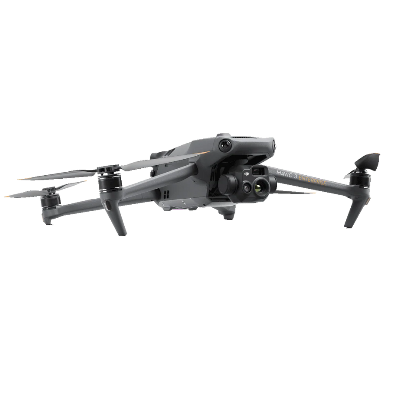
DJI Mavic 3 Enterprise 3E
The Mavic 3 Enterprise Series redefines industry standards for small commercial drones. With a mechanical shutter, a 56x zoom camera, and an RTK module for centimeter-level precision, the Mavic 3E brings mapping and mission efficiency to new heights. A thermal version is available for firefighting, search and rescue, inspection, and night operations.
Key Features
- Compact and Portable
- 56x Hybrid Zoom
- 640 x 512 px Camera
- 45-min Max Flight Time
- DJI O3 Enterprise Transmission
- Centimeter-level Positioning with RTK
- High-Volume Loudspeaker
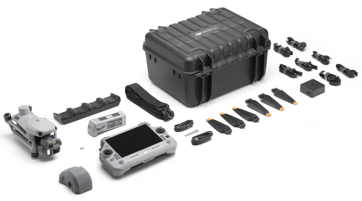
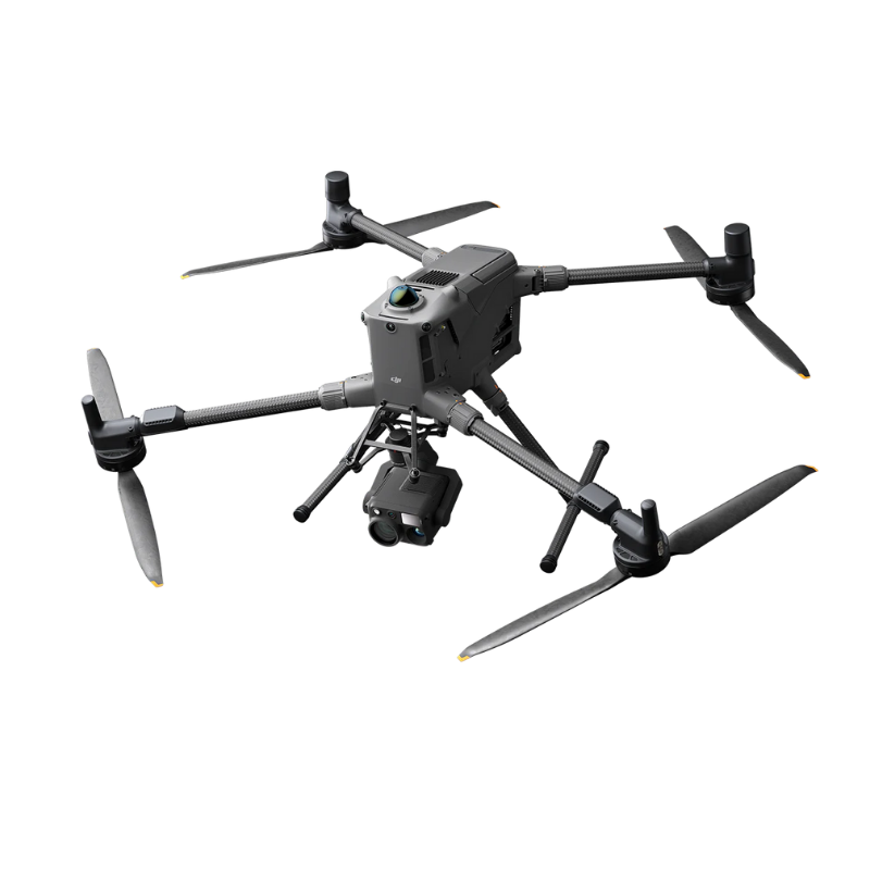
DJI Matrice 4 Series 4T
Flagship Intelligent Multi-Sensor Compact Drone
Introducing the DJI Matrice 4 Series, a new compact and intelligent multi-sensor flagship drone series for enterprise industries. The series includes Matrice 4T and Matrice 4E, each equipped with advanced features such as smart detection and measurement with laser range finder. Flight operations are now safer, more reliable, and powered by AI, with significantly enhanced sensing capabilities. The accessories for the Matrice 4 series have also been significantly upgraded.
The Matrice 4T is suitable for a wide range of industries, including electricity, emergency response, public safety, and forestry conservation. The Matrice 4E is designed for geospatial applications such as surveying and mapping, construction, and mining. A new era in intelligent aerial operations begins now.
DJI Enterprise Drones
DJI SENSORS AND PAYLOADS
- Home
- PRODUCT LINES
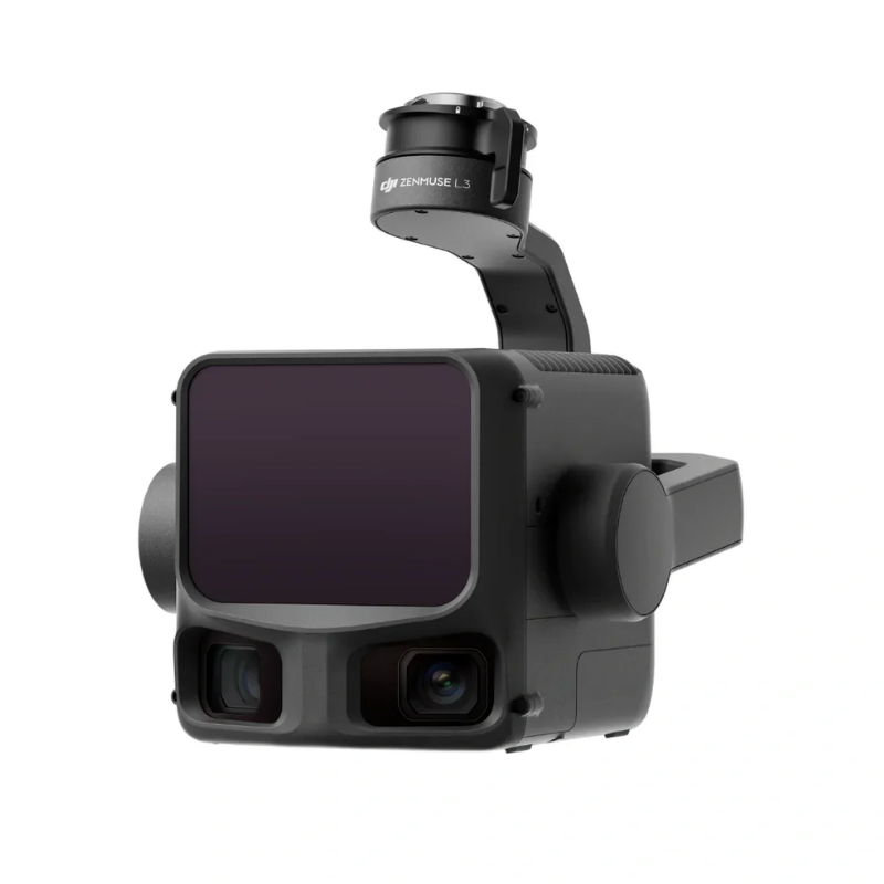
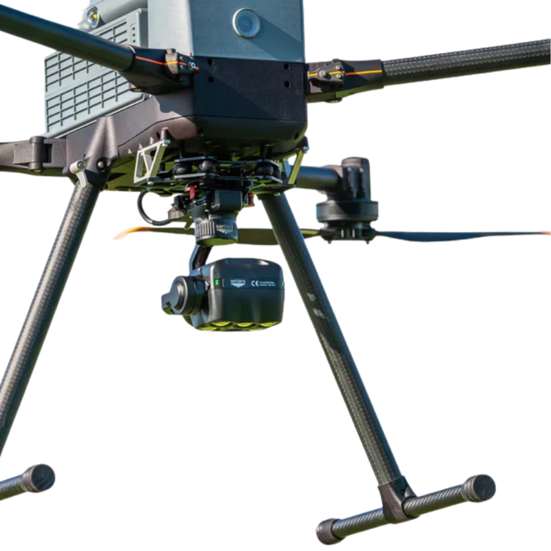
DJI Zenmuse L3 - Long Range LiDAR
DJI’s next-generation high-accuracy aerial LiDAR system features a long-range LiDAR capable of reaching up to 950 m even on objects with just 10% reflectivity. Dual 100MP RGB mapping cameras and a high-precision POS system accelerate geospatial data acquisition, enabling daily coverage of up to 100 km². Equipped with a 1535 nm Class 1 laser and dual 100 MP Micro 4/3 cameras, it delivers up to 950 m range and 2–4 cm accuracy for professional surveying and digital-twin applications. Built exclusively for the Matrice 400 RTK, the L3 integrates seamlessly into DJI Terra workflows to output point clouds, orthophotos, and 3D models—all within a single processing environment.
Key Features
- 1535nm Long-Range LiDAR
- Dual 100MP RGB Mapping Camera System
- High-efficiency mapping: covers up to 10 km² per flight or 100 km² per day
- Survey-grade accuracy: delivers 2–4 cm precision for mapping applications.
- Adjustable point-rate control: 100 kHz – 2 MHz to balance density and coverage.
- Compact low-power design: 1.6 kg payload draws only 64 W typical power.
- Dual 100 MP Micro 4/3 cameras: generate orthophotos and colorized point clouds.
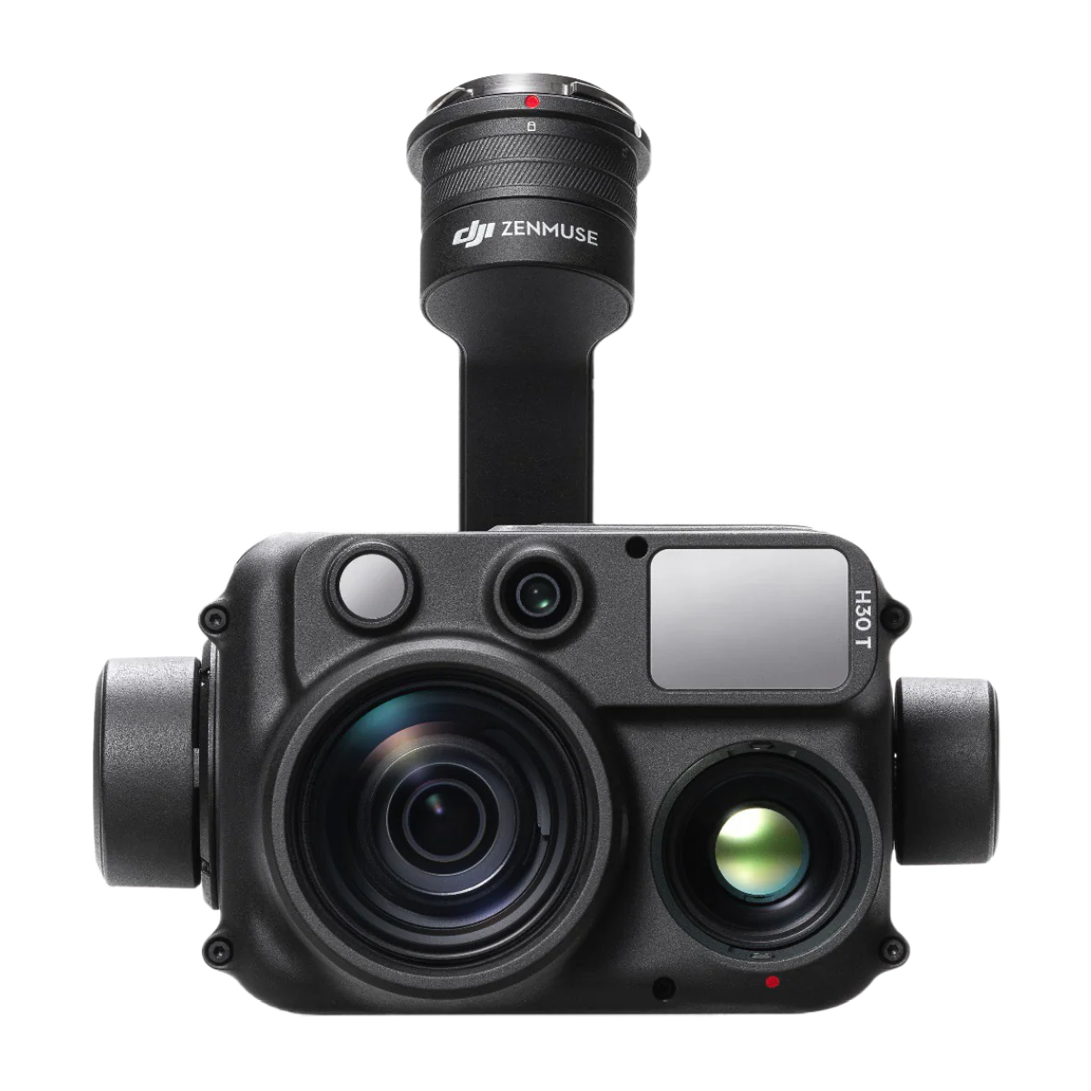
DJI Zenmuse H30T
Unparalleled Vision, Day or Night
The all-weather, multi-sensor flagship Zenmuse H30 Series integrates five major modules—a wide-angle camera, a zoom camera, an infrared thermal camera, a laser range finder, and an NIR auxiliary light. Employing cutting-edge intelligent algorithms, it revolutionizes perception and imaging standards, transcending the limitations of day and night vision. This makes it effortlessly suitable for a variety of operations, including public safety, energy inspection, water conservation, and forestry.
Key Features
- Further and Clearer Vision
- Enhanced Night Vision
- More Powerful Infrared Performance
- Smarter Multi-Scenario Operations
- Superior Environmental Adaptability
- More Reliable Information Sync and Retention
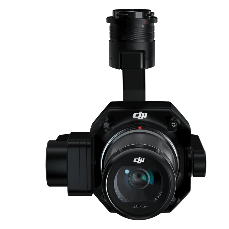
DJI Zenmuse P1 Camera and Gimbal
The Zenmuse P1 integrates a full-frame sensor with interchangeable fixed-focus lenses on a 3-axis stabilized gimbal. Designed for photogrammetry flight missions, it takes efficiency and accuracy to a whole new level.
- Accuracy without GCPs – 3 cm horizontally / 5 cm vertically
- High Efficiency – 3 km2 covered in a single flight
- 45 MP Full-frame Sensor
- 3-axis Stabilized Gimbal – Smart Oblique Capture
- Global Mechanical Shutter – Shutter Speed 1/2000 Seconds
- TimeSync 2.0 – synchronization at the microsecond level
Full-frame Camera
- 45MP Full-frame Sensor
- 4.4μm Pixel Size
- Low-noise, high sensitivity imaging extends daily operational time
- Take a photo every 0.7 s during the flight
- TimeSync 2.0 aligns the camera, flight controller, RTK module, and gimbal at the microsecond level
Sensors and Payloads
DJI SOFTWARE
- Home
- PRODUCT LINES
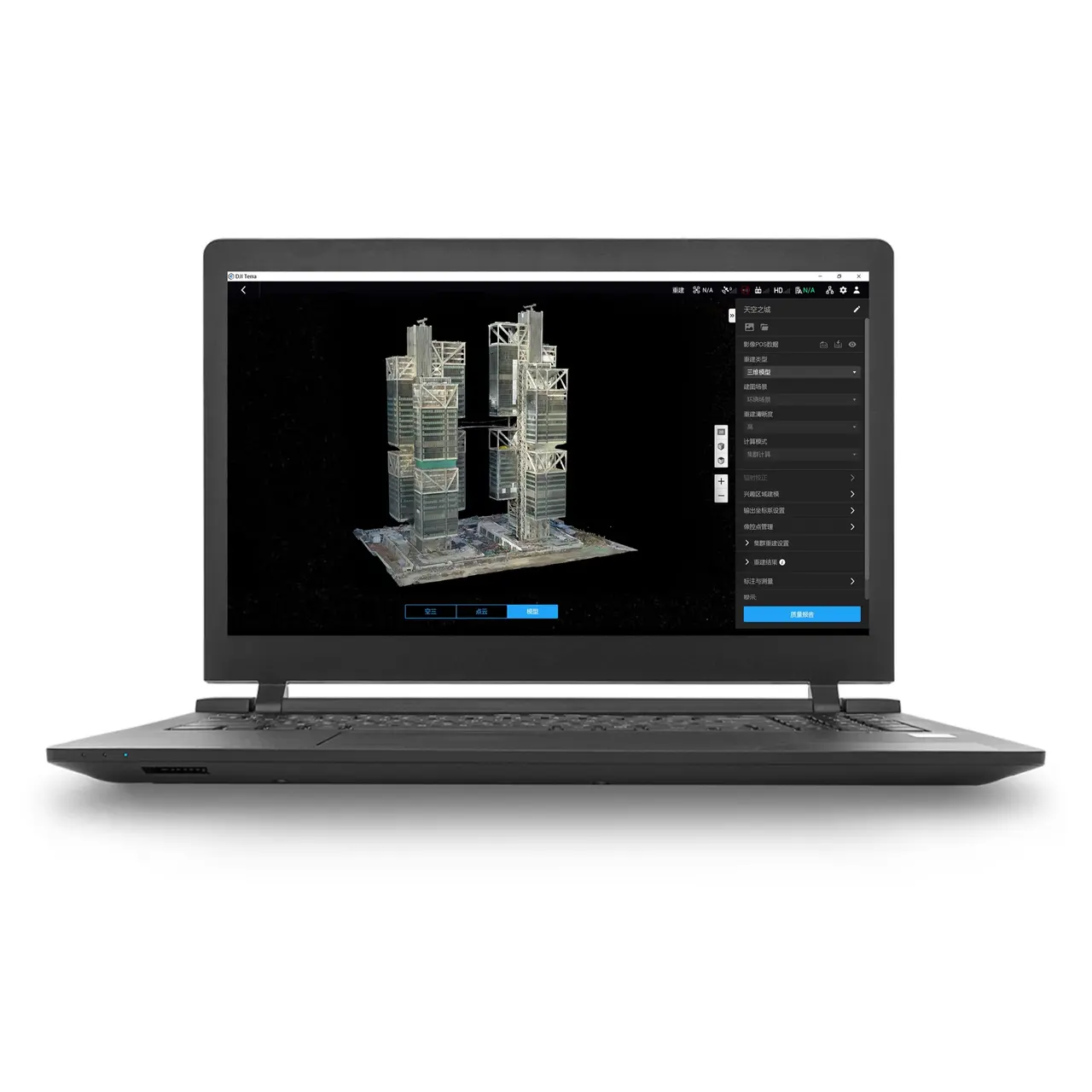
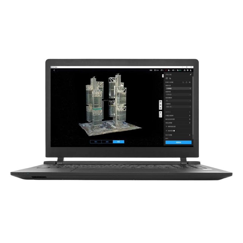
DJI Terra Flagship Permanent
DJI Terra is a powerful professional photogrammetry and 3D modeling software developed by DJI, designed to transform drone-captured data into high-precision 2D maps and highly detailed 3D models.
The Flagship Permanent version provides a lifetime license, granting unlimited, permanent access to core features with no renewal fees. It is the ideal solution for professionals who require accuracy, reliability, and a consistent workflow across projects in industries such as surveying, engineering, construction, inspection, and urban planning.
With DJI Terra, you can streamline processing, enhance decision-making, and deliver superior results—backed by DJI’s trusted technology and industry-leading innovation.
DJI Terra - Standard - Permanent Terra - Standard - Permanent Terra - Standard - Permanent
DJI Terra is an advanced photogrammetry and 3D modeling software developed by DJI, designed to convert drone-captured data into highly accurate 2D maps and detailed 3D models.
The Standard Permanent version includes a lifetime license, providing unlimited access to essential features with no recurring renewal fees. It is an ideal solution for professionals who require a stable, efficient, and reliable workflow across multiple projects.
Perfect for applications in surveying, construction, engineering, inspection, and mapping, DJI Terra helps streamline data processing, improve accuracy, and deliver consistent, professional results—backed by DJI’s trusted technology.
DJI Modify - Flagship - Permanent
DJI Modify is a professional AI-powered 3D mesh editing software developed by DJI, designed to refine, repair, and optimize 3D models generated from drone photogrammetry.
The Flagship Permanent version includes a lifetime license, providing unlimited access with no recurring subscription fees. It enables professionals to efficiently edit complex meshes, remove noise, fix surfaces, and enhance model quality with intelligent automation and precision tools.
Ideal for industries such as surveying, construction, infrastructure inspection, digital twins, and urban planning, DJI Modify streamlines post-processing workflows, improves model usability, and ensures clean, accurate, and presentation-ready 3D results—powered by DJI’s advanced AI technology.
Software
Quantum Systems
- Home
- PRODUCT LINES
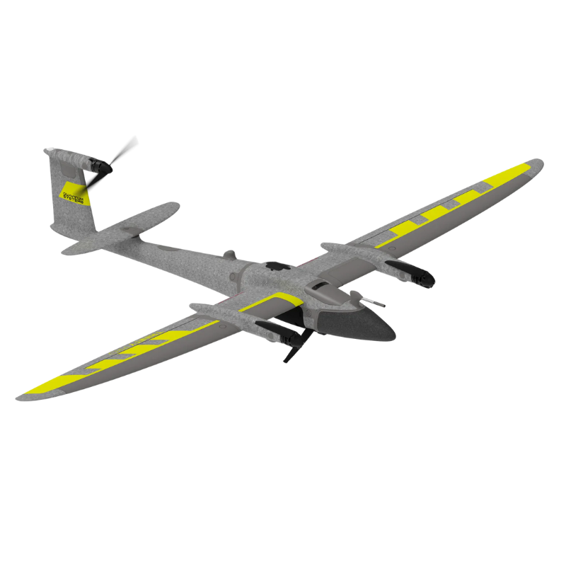
Quantum Systems Trinity Pro e-VTOL
Trinity Pro is a future-proof mapping drone designed to adapt to changing requirements and accelerate decision-making through advanced aerial data.
It features an extended flight time of 90 minutes and easy to use mission planning software QBase 3D. The choice of integrated cameras is unrivaled – RGB, Oblique, Multispectral and even LiDAR – making it the right tool for any mapping application.
Key specifications
- Next-generation eVTOL fixed-wing mapping drone.
- Manufacturer QuantumSystems
- Trinity Pro Cameras
Quantum Systems
QUANTUM CAMERAS & SENSORS
- Home
- PRODUCT LINES
Phase One P5 One P5
Is the revolutionary flagship 128MP Medium Format camera that transcends its role as a mere camera – it‘s a survey-grade instrument set to redefine the way you capture. With an astounding 128-megapixel resolution, it delivers unprecedented image detail and resolution, ensuring the utmost accuracy and reliability in your survey data. Achieve exceptional results, down to 0.5 cm RMS XY/Z* absolute accuracy, making your data impeccably trustworthy. When paired with the Trinity Pro, the P5 swiftly covers large areas with survey-grade precision, significantly reducing time and costs compared to conventional methods. The electronic global shutter, combined with metrically calibrated lense and sensor, reduces the necessity for extensive software corrections caused by pixel distortion, ensuring the preservation of high-quality data. Take your surveying to the next level with the P5!
Sony ILX-LR1
The Sony ILX-LR1 camera, with its cutting-edge high-accuracy capabilities and expansive coverage, seamlessly integrates into Quantum Systems drones and allows direct camera control, while delivering exceptional image quality. The camera harnesses advanced sensor technology and processing power, resulting in a ultra compact solution that elevates project efficiency. Users have the flexibility to customize settings to suit any mission, reducing data load and streamlining workflows, while maintaining image quality.
Technical Specification
- Sensor resolution 61.0 MP (9504 × 6336 px)
- GSD @100m AGL 1.57 cm/px
- GSD @120m AGL 1.88 cm/px
- Coverage @120m AGL 491 ha (1.88 cm/px GSD, 70% overlap)
- Coverage with 0.7 cm/px GSD 184 ha (@45m AGL, 70% overlap)
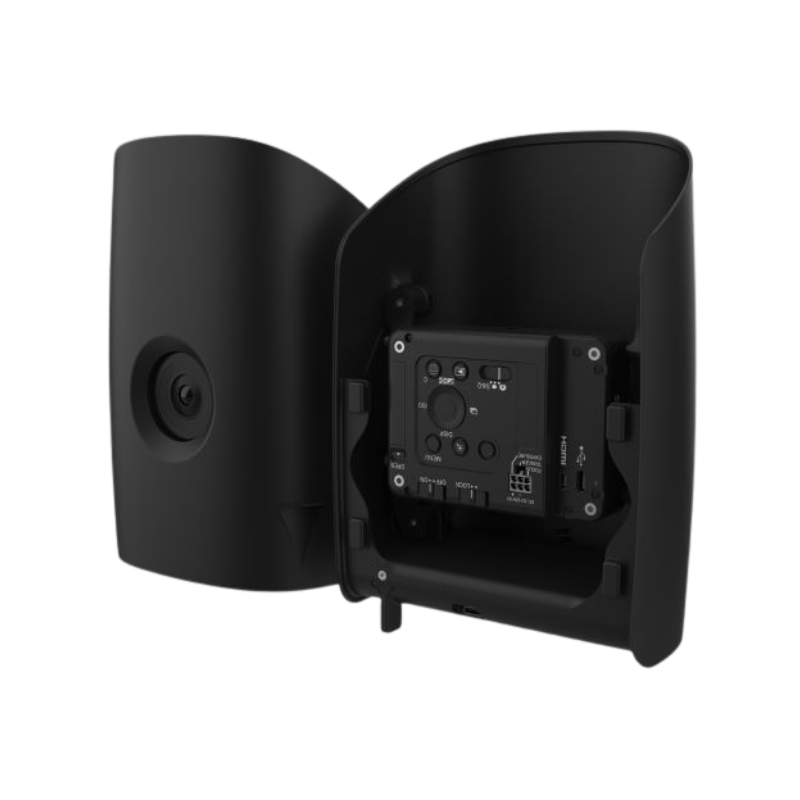
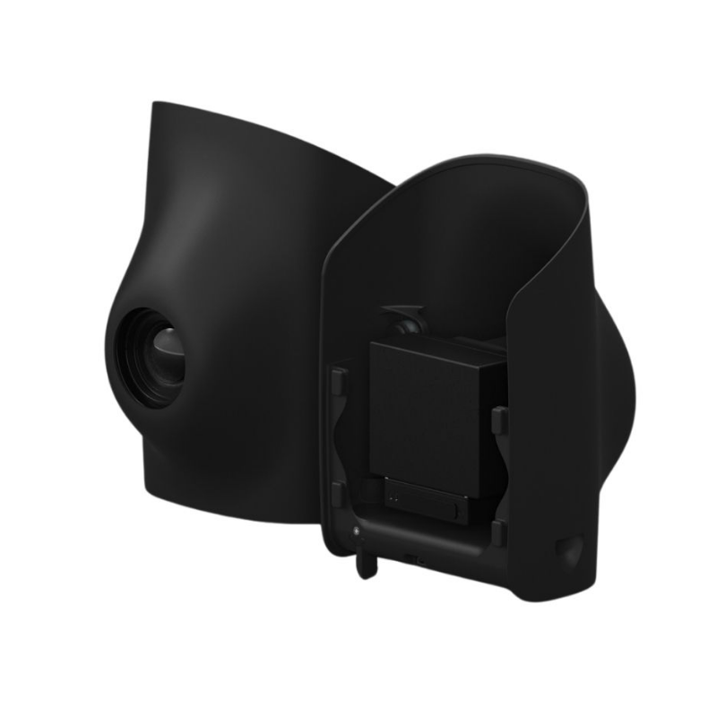
Qube 640
LiDAR Scanner
The Qube 640, a specialized LiDAR sensor co-developed with YellowScan for Trinity Pro and Tactical drones, features a selectable FOV (field of view) of up to 176°. Combined with Trinity’s capabilities, it enables 32 km corridor scanning with one single flight. At 120° FOV, it improves productivity by 50% compared to its predecessor, the Qube 240. The sensor ensures improved vegetation penetration, detailing foliage and trunks, and facilitates vertical scanning applications with reduced outer edge mismatches, thanks to the new IMU. An integrated 8MP RGB camera enables LiDAR capture and colorization in the same flight.
Technical Specification
- Scanner Hesai XT32M2X
- GNSS Inertial Solution SBG Quanta Micro
- Integrated Camera 8 MP (for colorization purposes)
- Laser Range 300 m
- Precision 3 cm
- Accuracy 2.5 cm
Cameras & Sensors
Inspired Flight
- Home
- PRODUCT LINES
Inspired Flight IF1200A - BlueUAS
The Inspired Flight IF1200A is a heavy-lift, industrial-grade UAV engineered for demanding commercial, defense, and enterprise missions. Designed for reliability and performance, it supports a wide range of payloads for applications such as inspection, mapping, surveillance, public safety, and defense operations.
Paired with the BlueU S secure communications system, the IF1200A delivers encrypted data links and secure command-and-control, ensuring mission integrity in sensitive and regulated environments. Its rugged airframe, long endurance, and modular payload capability make it a trusted platform for critical operations where precision and security are essential.
Package Includes:
- Encrypted ruggedized laptop ground station
- 6 folding propellers
- 2 spare folding propellers
- Blue Herelink controller
- Rugged transport case
IF800 - Blue Herelink + Sentera 6X Bundle
The Inspired Flight IF800 is a compact, high-performance industrial UAV designed for precision data capture and reliable operations in demanding commercial environments. Lightweight yet powerful, it delivers exceptional stability, efficiency, and mission flexibility.
Integrated with the Blue Herelink digital control system, the IF800 provides low-latency HD video, secure command-and-control, and long-range communication, ensuring confident and responsive flight operations. The included Sentera 6X multispectral payload enables advanced aerial data collection for applications such as precision agriculture, environmental monitoring, mapping, and analytics.
Package Includes:
- 1 × IF800 aircraft
- 4 × propellers
- 1 × Vision2 ground controller
- 1 × rugged transport case
- 1 × Sentera 6X payload
- 2 × batteries
- 1 × charger
Inspired Flight
Parrot
- Home
- PRODUCT LINES
Parrot ANAFI UKR micro-UAV Drone
Designed to meet the operational demands of both frontline defense missions and public safety deployments, the ANAFI UKR range combines tactical-grade resilience with embedded autonomy in a compact, easily deployable format.
Key Features
- Sensor: FLIR BOSON – Resolution: 640 x 512 px
- Satellite navigation: GPS, GLONASS, Galileo & BeiDou
- Sound power level at 1 m (3 ft): 77 dBA
- Service ceiling: 5,000 m above MSL (Mean Sea Level)
- Zero data shared without user consent
- Flight Planning with waypoints and points of interest
- Opitcal Navigation
- Native Mapping missions within FreeFlight 8
- 38 Minute Battery Life
Parrot ANAFI USA | GOV Edition
A DRONE DESIGNED FOR GOVERNMENT AGENCIES
Manufactured in the US – ANAFI USA offers the same high-end security, durability and imaging capabilities as Parrot’s Short-Range Reconnaissance (SRR) drone designed for the US Army. ANAFI USA’s data encryption and privacy features are compliant with the European Union’s General Data Protection Regulation (GDPR), delivering best-in-class privacy and security for sensitive missions.
STABILIZED X32 ZOOM THERMAL IMAGERY | 4K VISUAL EXCELLENCE
When firefighters arrive on the scene of a fire, the most important need is to view hot spots while also being able to assess the entire visual scene. ANAFI USA’s gimbal and advanced optics were designed with this challenge in mind. The 32x zoom is designed around two 21-megapixel cameras, allowing operators to see details clearly from up to 5 km (3.1 mi) away.
Parrot ANAFI Ai Drone | The first 4G ANAFI Ai Drone | The first 4G ANAFI Ai Drone | The first 4G
The first 4G connected robotic UAV, Verizon 4G LTE connectivity, Embedded Artificial Intelligence, Made for Mapping & Modeling, 48MP stills at 1fps
CYBERSECURITY BY DESIGN
For the first time, Parrot ANAFI Ai embeds a Secure Element in the drone and in its Skycontroller 4. The 4G link between the drone and the user’s phone is encrypted. The Secure Element protects both the integrity of the software and the privacy of data transferred.
A UNIQUE ROBOTIC PLATFORM
Parrot’s large partner ecosystem delivers a wealth of specialized applications and services for a variety of professional uses.
Parrot Business Solutions
Autel Robotics
- Home
- PRODUCT LINES
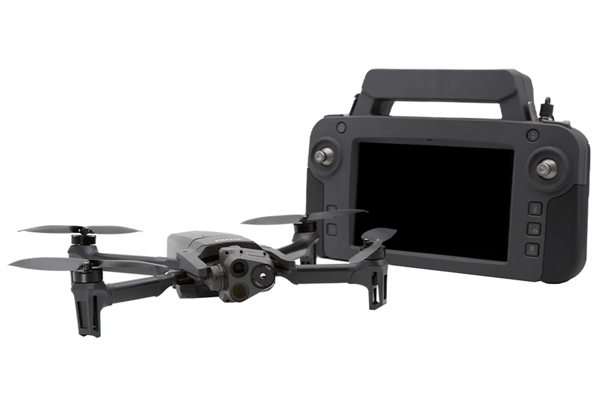
EVO II Dual 640T Enterprise Bundle V3
The Autel Robotics EVO II Dual 640T Enterprise V3 is a powerful, all-in-one dual-sensor drone solution engineered for public safety, inspection, and industrial operations. Equipped with a 640×512 thermal imaging camera and a 48 MP visual sensor, it delivers exceptional situational awareness, day or night.
The Enterprise Bundle V3 includes essential accessories that enhance operational capability in low-visibility and high-risk environments, ensuring teams are fully equipped from day one.
Key Features & Benefits:
- High-resolution 640×512 thermal camera for precise heat detection
- 48 MP RGB camera for detailed visual inspection
- Enterprise accessories for enhanced visibility and communication
- Rugged, foldable design for rapid deployment
- Secure data handling with no mandatory cloud connectivity
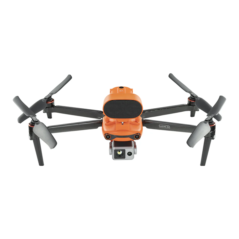
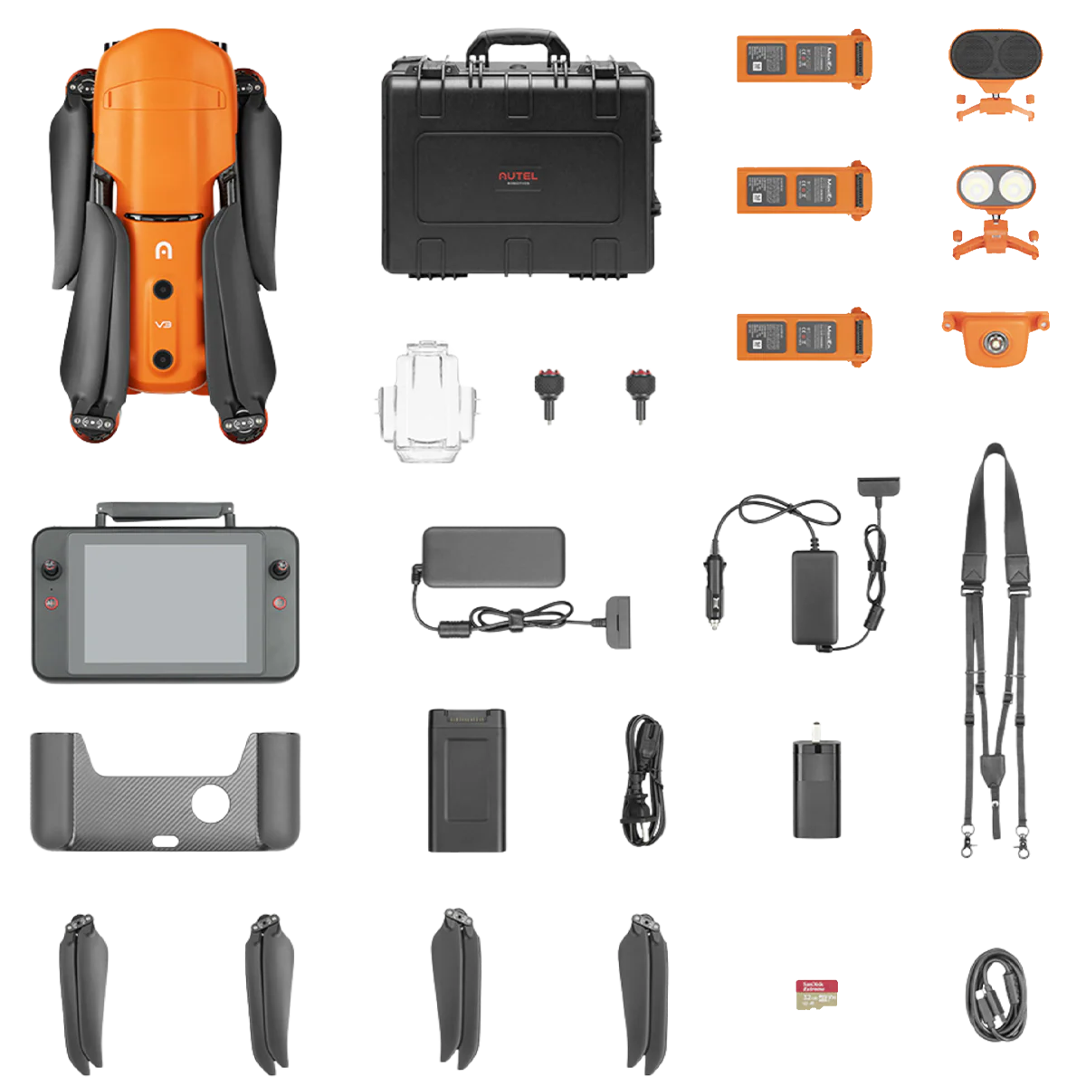
EVO II Pro 6K Enterprise Bundle V3
he Autel Robotics EVO II Pro 6K Enterprise V3 is a high-performance professional drone solution designed for detailed inspection, mapping, and public safety operations. Equipped with a 1-inch CMOS sensor capable of capturing stunning 6K ultra-high-resolution imagery, it delivers exceptional clarity, color accuracy, and low-light performance.
The Enterprise Bundle V3 includes essential accessories and tools that enhance operational efficiency, visibility, and communication, providing a ready-to-deploy professional solution straight out of the box.
Key Features & Benefits:
- 6K ultra-high-resolution camera with 1-inch CMOS sensor
- Superior image quality for detailed inspections and mapping
- Enterprise accessories for enhanced situational awareness
- Foldable, rugged design for rapid deployment
- Secure operation with no mandatory cloud connectivity
Autel Robotics
Freefly
- Home
- PRODUCT LINES

Alta X + Pilot Pro (NDAA)
The Freefly Alta X is a powerful, modular heavy-lift industrial drone platform engineered for demanding commercial and government operations. Designed for flexibility and performance, Alta X supports a wide range of payloads and mission profiles, making it ideal for inspection, mapping, cinematography, research, public safety, and defense applications.
The included accessories and spare components ensure mission readiness, ease of maintenance, and extended operational life in the field.
Key Highlights:
- NDAA-compliant platform for government and regulated operations
- High payload capacity with modular, open-frame design
- Pilot Pro controller with RFD900 radio for long-range, reliable connectivity
- Designed for rapid maintenance and field servicing
- Ideal for enterprise, public safety, and defense missions
Astro Max (NDAA/Blue)
Astro Max is Freefly’s ultimate compact industrial drone platform. This model has special hardware and software making it both NDAA compliant and DIU Blue approved.
Freefly understands the need for quality tools. For more than 10 years, Freefly aircraft have carried high end imagers for industry and high-end productions around the world. It carries valuable payloads in high-pressure situations.
Each Astro Prime (NDAA/Blue) includes the the basics of your DIU compliant drone kit, ready to mount a variety of payloads.
Includes:
- Astro Max Drone
- Simple tools, props, landing gear and some spare bits
- NDAA and DIU approved firmware
- Freefly Pilot Pro controller
- Doodle Labs RF, NDAA and DIU Blue 2.4 GHz radio
- Compact Travel Case with Telescoping handle and fixed wheels